A Personal Adventure – Day 01

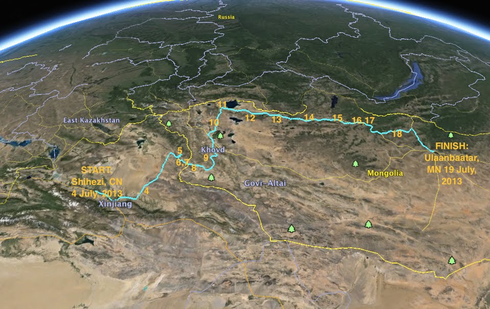
I got onto the G30 highway heading east towards Urumqi, the regional capital and the nexus point for all the roads in Northern Xinjiang. The highway hugs the foothills of the formidable Tian Shan Mountains heading east and west, all the way to the Alashankou land port with Kazakhstan. The road to the east was clear in the afternoon sunshine, and I was cautiously optimistic that I could reach my objective for the day, the town of Fuyun. Nestled in the Altai mountains, the settlement sits to the south of the jagged seam where Russia, China, Kazakhstan and Mongolia come together. This was to be my launchpad for the border crossing, which in my mind loomed like a massive sinister unknown. I had fears of phantom bureaucratic hurdles springing up on my arrival, vines of red tape snarling me to some dusty shack in the desert, forbidden to cross over for some inscrutable yet very Chinese reason.

I made decent progress through the afternoon, despite a brief stop to replace a bolt on a support strut that had terrifyingly come loose while at speed. At the outskirts of Urumqi I turned north onto the 216 national highway, which would take me through the heart of the Gurbantünggüt Desert, home to the furthest point on land away from any ocean, over 1600 miles.

IMG_0007-002

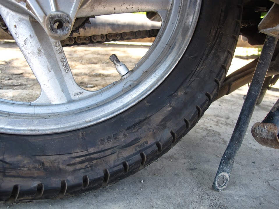
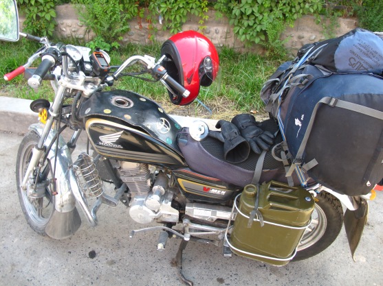
This is what fell off, produced a rather unnerving scraping sound

North of Urumqi some nasty bumper to bumper traffic congealed, grinding my progress to a crawl for almost an hour. This, combined with the now boiling intensity of the sun, began to dehydrate me rapidly as I was wrapped in layers of highly-protective-yet-not-very-breathable leather and canvas. Traffic on a motorcycle is annoying, consisting of waddling awkwardly among plodding cars. When I was not quick enough to move forward the usual ten feet or so the eager driver behind would honk incessantly until I picked up the slack. My right boot was getting so hot from the sun and the idling engine that I began to worry its rubber sole might actually melt into the asphalt. I could not wait to get off these big faceless arteries and onto the more local routes, where traffic might mean a few sheep or the odd camel.

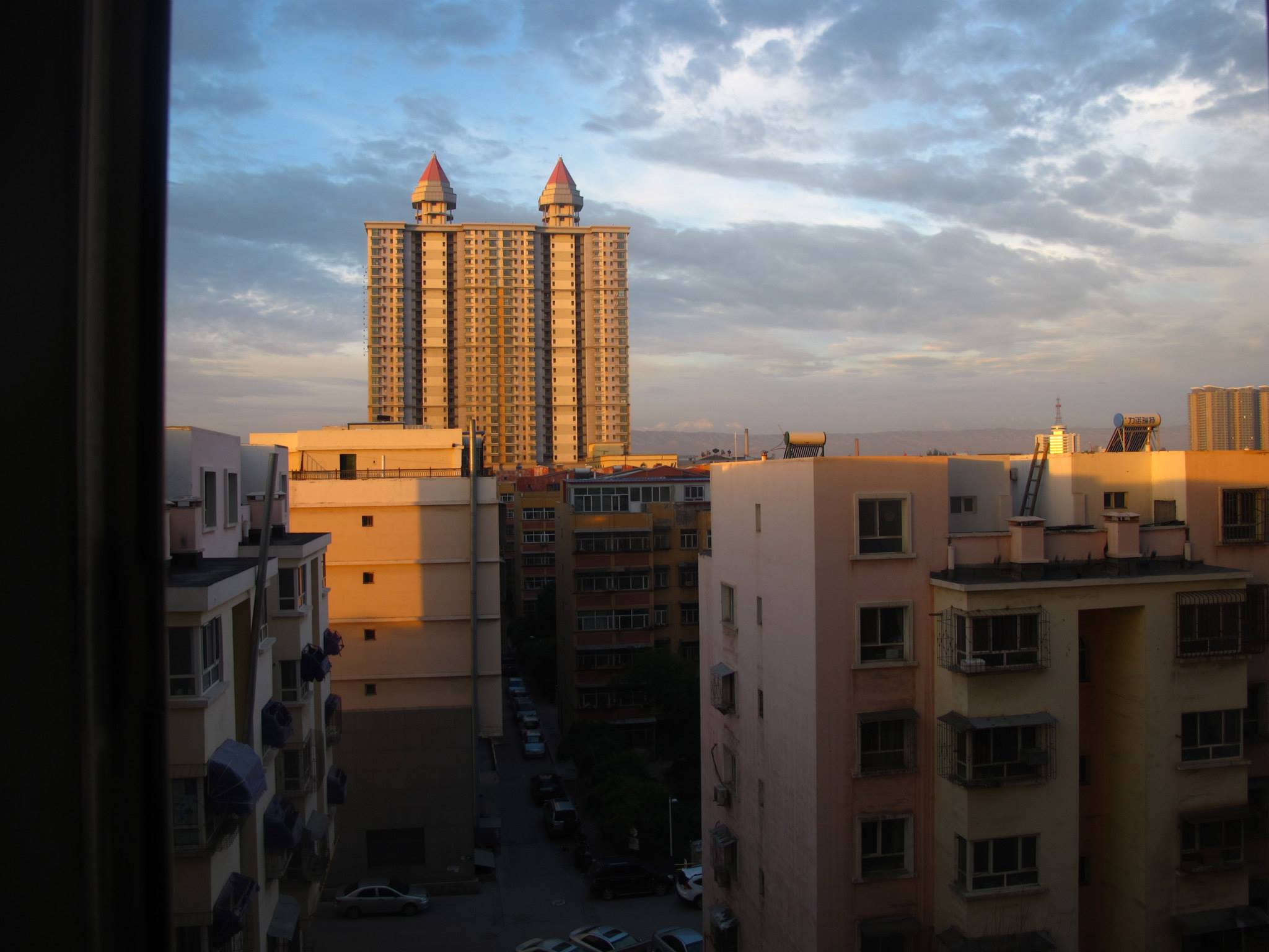
Once I passed a highway interchange the traffic mercifully cleared, and I pulled back on the throttle to speed up and let the wind cool me off, weaving gleefully between the lines to celebrate my return to open space. Exhausted from the heat, I stopped in a town on the outskirts of the desert called Fukang. I needed to retie my now sagging luggage, buy a funnel for fuel, and get some food. The town was another Han chinese grid of bright and hopeful concrete tower blocks, streetlights laced with the usual alien-looking neon strip lighting, and a small yet bustling core of urban activity: shoppers examining racks of clothing in the warm evening air to the thump of house music blaring from nearby speakers. These towns seem very strange when entering from the surrounding scrub. In America we rarely see such distinct geographic margins. Towns have ballooned out into the suburbs, and when approaching you enter an urban gradient, as developments, strip malls and movie theaters pop up with increasing frequency the closer you get. Here there was a discrete margin at which the buildings stopped and the desert began. To be in the center of these small cities felt bizarre, as if all this activity was somehow contrived, irrelevant when considered in the context of the vast empty expanse beyond the little urban cluster.

After asking a local for a recommendation, I was led to a restaurant just off one of Fukang’s main avenues. I ordered the regional staple Banmian/laghman: thick hand-drawn noodles topped with a spicy stew of meat and vegetables. While slurping it down I looked at the map in dismay; there was no way I could make it to Fuyun, another 600 Km north with nothing but desert in between. My itinerary had been overly ambitious, and the process of reconciling my idealized itinerary with reality would become a daily routine. I decided to compromise, settling for Wu Cai Wan (five colored hills) which was a more reasonable 200 clicks up the road. The town is named for the layers of bright colored sediment that have been exposed by the gouging desert winds.
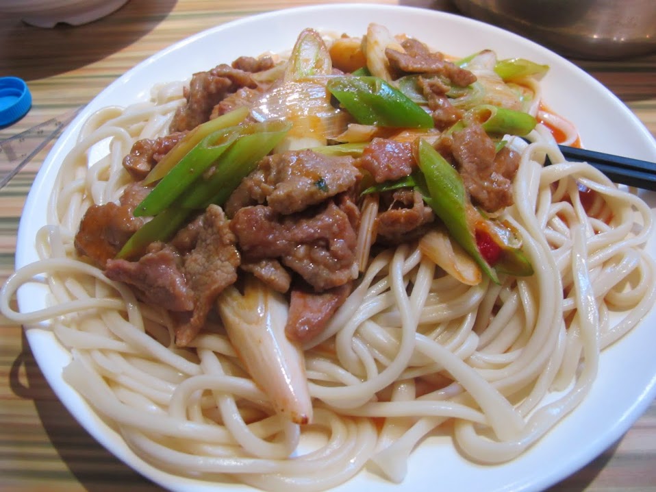
IMG_0014-002

Pork Ban mian, yum!

I headed out of town around 8:30 PM back onto the 216. I was warned by some locals who helped me load my bike to avoid the road after sundown. Apparently after dark trucks from coal mines that dot the region clogged the highways, carrying their sooty cargo down to the population centers and freight hubs, making for rather dangerous driving conditions. Already having compromised my itinerary once, I was determined to make more progress, so I shrugged off their advice to delay and set out.

IMG_0022-002

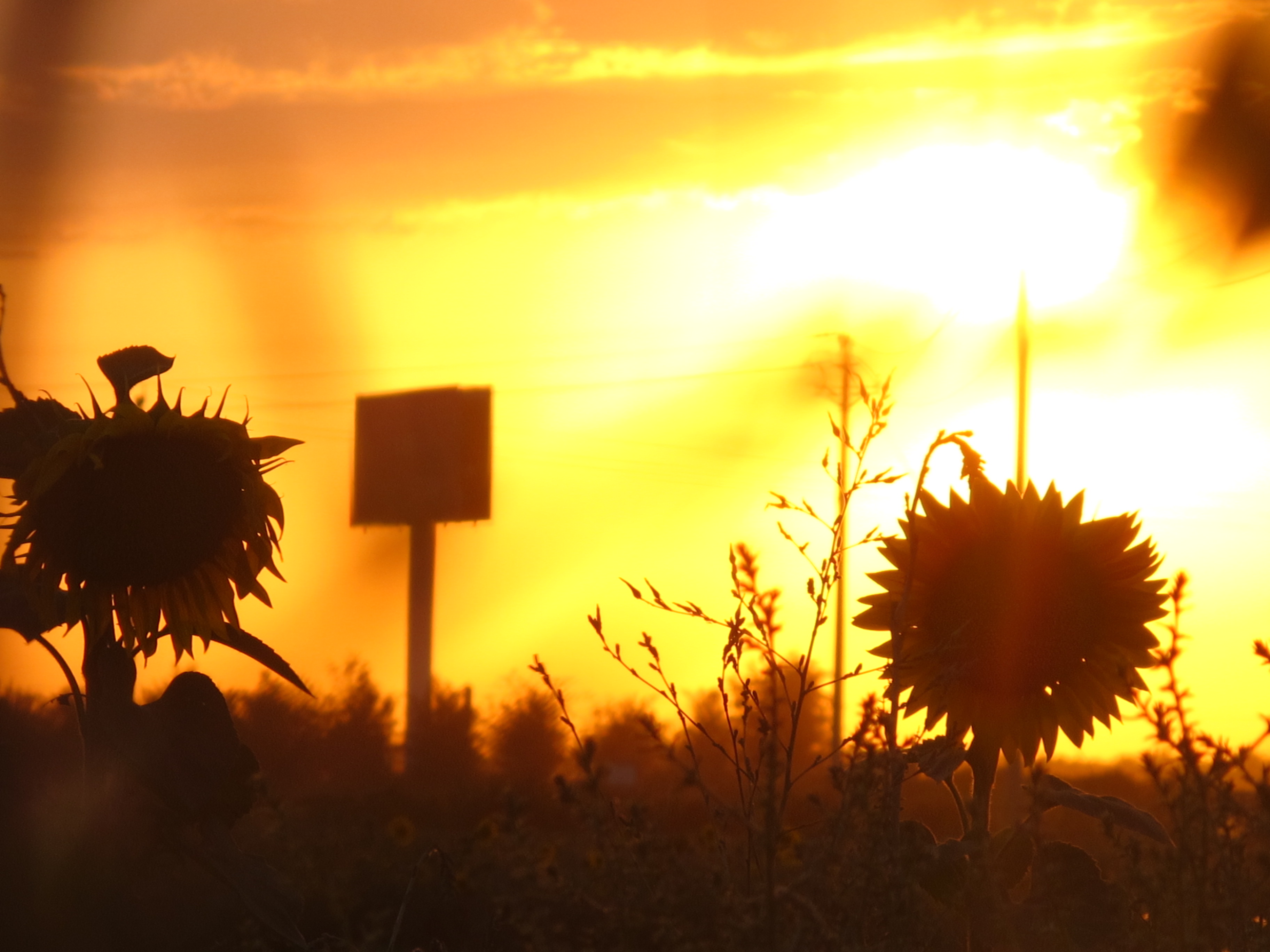
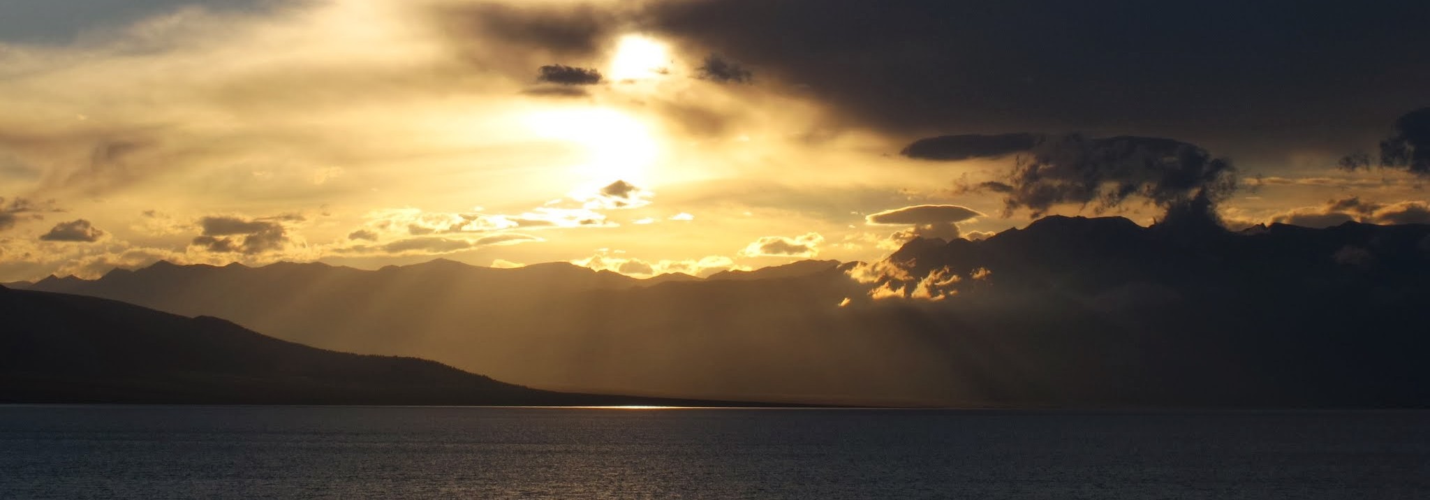
sunset view from route 216 over sunflower fields

IMG_0013-001

Route 216 heads east towards Jimsar, before striking north into the Gurbantünggüt Desert towards the Altai region

As I struck out north into the desert the sun dipped below the western horizon. True to the locals’ words large red lorries began to fill the previously empty road, wheezing and cranking their heavy loads at high speeds, and soon I was sandwiched in the midst of the massive line of them. The one behind me was no more than 15 feet away, and when the harsh gusts of wind ripped across from the desert I could see chunks of coal fly off the truck ahead of me. The cargo was poorly secured with tarps, and I feared getting beamed in the face with a lump that would take me down and trample me under the convoy. At one point I looked up and noticed the characters on the back of a truck in front of me: “contains highly corrosive material”, at which point imagines of me rear-ending the truck and slowly dissolving into a tidy puddle by the roadside filled my head. I slowed way down, and I began to regret my decision to push on.
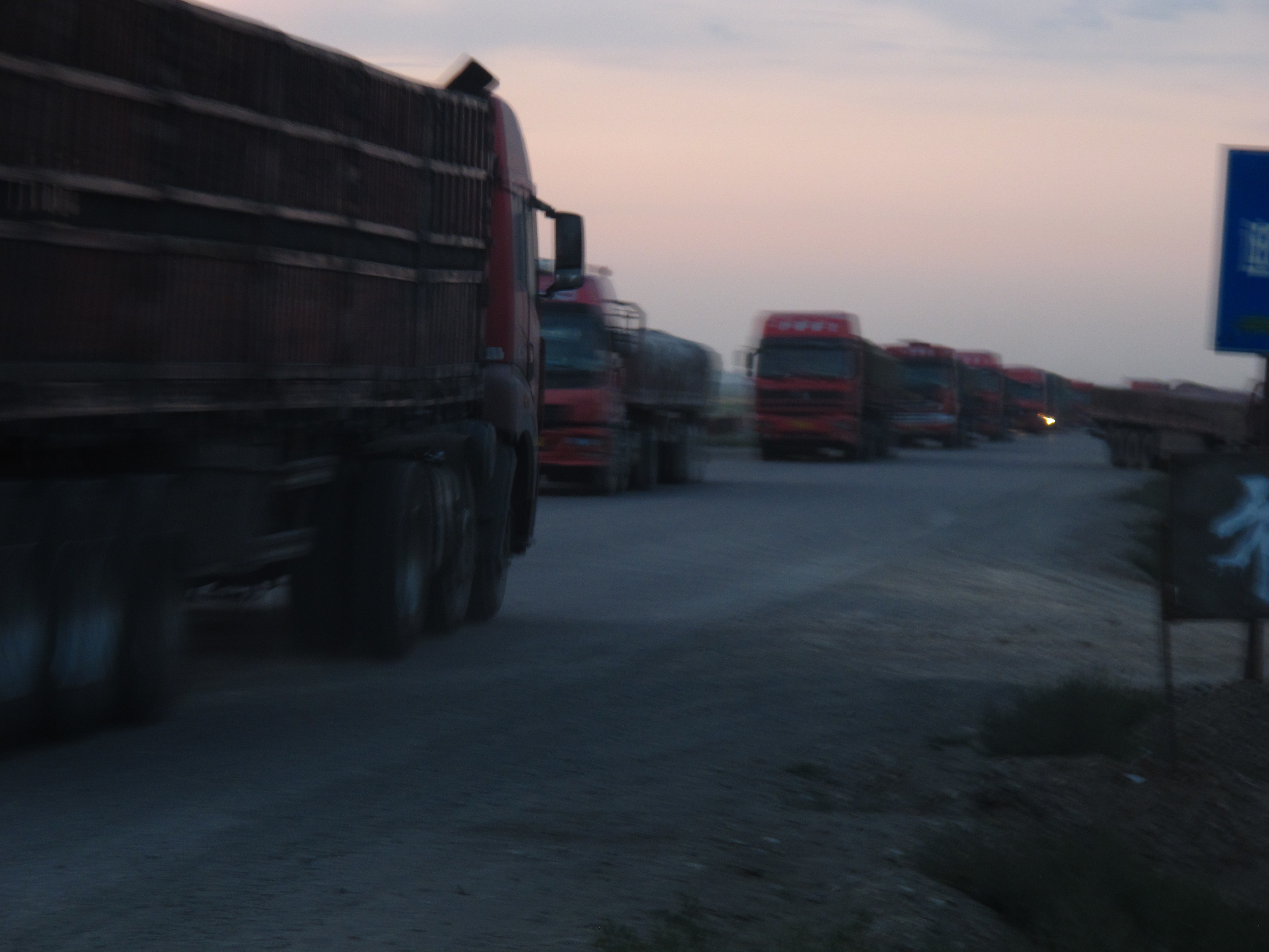
IMG_0033-001

So many trucks!!!!!

Thankfully after a nerve-wracking hour the ant-line of trucks took a turn to the left, chugging west towards a presumable mine. The road cleared and soon I was alone again. As I continued north into the desert the light faded quickly, and the winds picked up to a roar, pressing the collar of my jacket onto my throat like it was out to choke me.  Around me the landscape shifted from a flat scrubland to a series of rolling hills, resembling sandy beachside dunes. I found myself having to stop repeatedly to take a break from the wind. Signs going by warned of the wildlife crossing the roads in the area, a designated nature preserve which included populations of wild bactrian camels.

I didn’t see a thing in the darkness, and soon the wind had chilled me to the bone. As the temperature continued dropping I longingly imagined a hotel room and hot shower waiting for me. The fatigue of the first day’s ride, at this point approaching 10 hours, was taking its toll.


IMG_0046-002

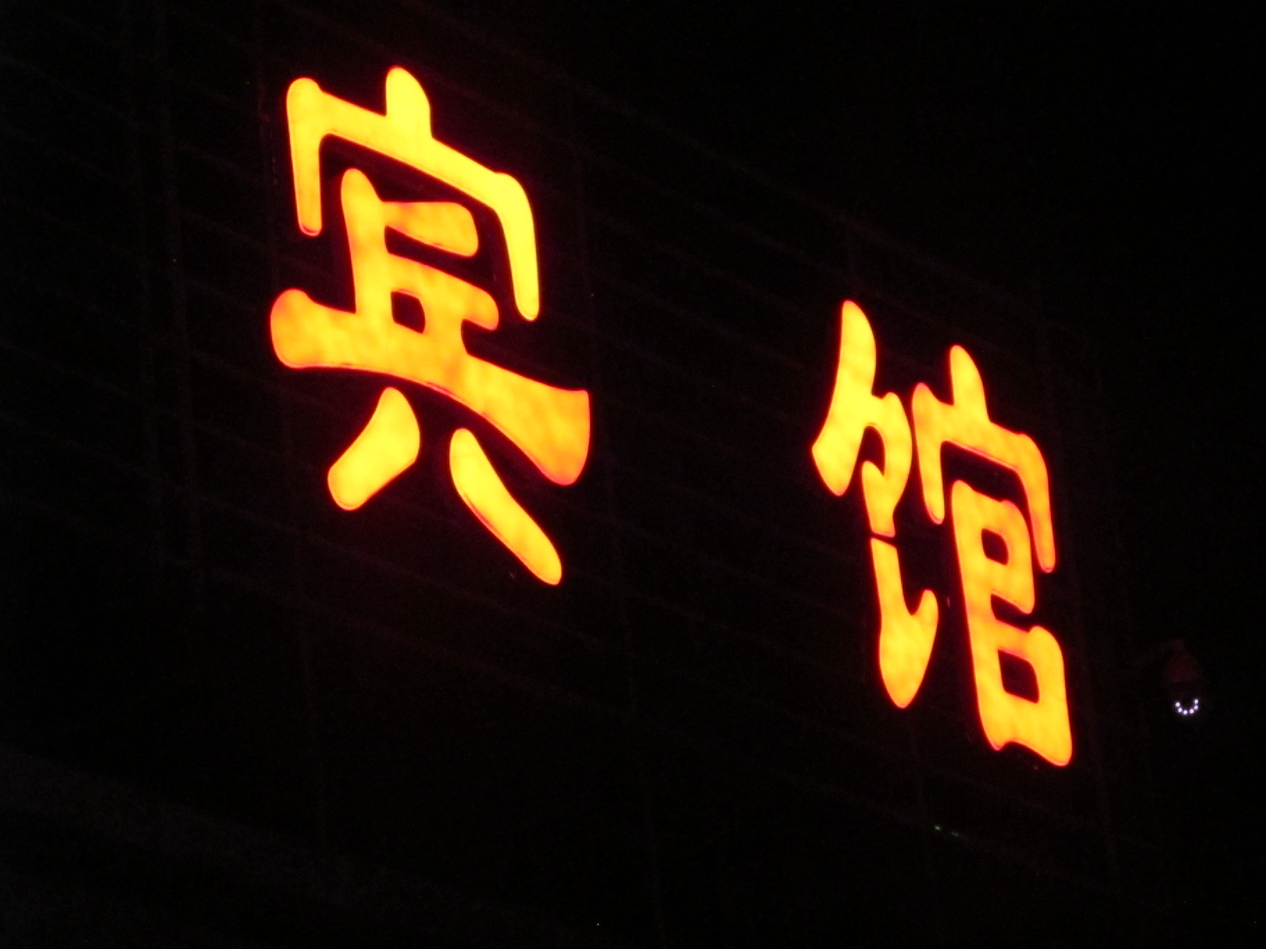
“Hotel”, My stopping point for the night

Fortunately I soon saw the telltale neon lights on the horizon that indicated hotels and the small outpost of Wu Cai Wan. I pulled in wearily and unloaded my gear by the cheapest looking one and checked in. I was shocked to see the volume of dust that streamed out when I got in the shower, just from a single day’s ride. I tried to take down some notes but fell asleep within minutes, completely exhausted. I’d make it a paltry 350 km, barely half my goal for the day. Yet despite this, my spirits were still undimmed, perhaps naively. My barely legible half-conscious notes read, “I definitely feel like I can do this now. I’ve already dealt with so many hurdles to get here, so what’s a few more!”

Day 01 Progress

The day’s progress


A personal adventure – Groundwork

By July 4th I was ready to set out. I had a plan: drive along the Chinese highway north into the dusty scrub of the Zhunggar Basin to the border crossing at Takeshiken–the western land crossing into Mongolia that had opened up to foreigners in 2011. From there I would head along the local roads for several days until I hit the Northern Route, one of three main arteries linking the far western fringe of the country to the capital Ulaanbaatar. Once I was on this road I imagined it would be plain sailing heading east, gradually approaching denser settlements.

My bike, a 250 cc Honda cruiser, had recently had an entire engine overhaul, along with a frame welded to the panniers to carry a jerry can of extra fuel, which would be critical in the areas of Mongolia where fuel stations are commonly 300 miles apart or more. At Lao Deng’s suggestion, I had swapped out my tires for a tubeless variety, to minimize the chances of puncture. For gear I carried the following: a basic set of tools, tent, sleeping bag,  small camping stove, rain gear, and a couple spare changes of clothes. For food I had a sizable cache of Ekströms instant blueberry soup, courtesy of a recent visit from my Swedish uncle Olle, perfect for some vitamin C and quick energy when fresh fruit would be scarce. Over the trip I bought bread where available and lots of canned sardines, and ate simple but filling meals.

With help from the outstanding resources http://www.openstreetmap.org and especially http://www.openmtbmap.org I had also gathered detailed contour maps of the entire country of Mongolia. It is amazing that with a few quick downloads to a portable gps device I held in my hand the ability to navigate to the very limits of civilization, thanks to the wonder of the internet and freely available satellite data. Not too long ago I would have been completely reliant on hard-to-obtain Soviet topographical maps to find my way. Still, I carried a basic roadmap + compass to be safe.

I had also finally obtained my Chinese motorcycle license, which had required a long gauntlet of choreographed red stamping that seems to define Chinese bureaucratic dealings. After working up to a red stamp of sufficient size and prestige I was allowed to take the two written license exams in Mandarin, barely scoring the necessary 92% on the second one to pass. Yet all the pain and effort had been worth it when I was able to walk to my local police station and talk to the smartly uniformed receptionist (who by now knew me well), to receive a shiny greenish card replete with concerned-looking head shot and my name in Chinese characters printed beside it. All this to make sure I would be able to pass the highway police checkpoints, found increasingly frequently with the rising tide of ethnic violence in the region.


1073859_10200281752277797_18717962_o (1)

Shihezi’s tallest building at dawn, as viewed from my apartment, glaciers of the Tian Shan can be seen barely over the horizon

So on the morning of the 4th I walked down to the university’s foreign affairs office to drop off my apartment key and say my goodbyes to Jason, our amiable Chinese liaison. He had handled all our expat gripes and concerns through the year with grace and kindness. He gave me my last paycheck and a warm handshake, though he was openly incredulous about my plan. I then walked by the English department office to say farewell to my colleagues, who wished me luck for the trip. These goodbyes seemed to have a heavy permanence to them, since it was almost certain I would never come back to Shihezi again. I then had a quick last lunch with my co-teacher Will at our favorite dumpling place. Will was another American and one of only 6 foreigners in the entire city, and over the year we had developed the tight bond that seems almost inevitable among young expatriates in an isolated, alien location.

Image

Fully Loaded!

As I saddled up, struggling to find the balance on the heavily-laden motorcycle, I felt electrified. I was going ‘off the grid’. No one was coming after me. Now was the moment where theory met practice, with all its beautiful unpredictable quirks.

I kicked the bike to life, waved goodbye to Will, and set off towards the main thoroughfare that would take me to the highway, and from there onto Urumqi and points north.

A personal adventure – prelude

Last summer I took a motorcycle journey on my own from Shihezi, Xinjiang, the quiet, dusty college town where I had been teaching English for a year, up across a finger of the Gobi Desert and across the Mongolian Altai Mountains, riding over the oceanic steppe all the way to the smoky, sprawling capital, UlaanBaatar. The trip took just over two weeks to complete and covered over 1700 miles (less than 10 percent on paved roads), and looking back it is clearly the most visceral and meaningful trip I have ever taken.

My ultimate route, extracted from GPS data

I had no grand purpose to my wandering, I simply wanted to get out there, to travel alone across the most remote place I could get to, in this case, western Mongolia. Pure wanderlust. My parents had apoplectic fits as I tried to explain the trip to them over a patchy skype connection a few hours before I set off. I couldn’t logically support my reason for taking the trip at the time, for taking on the considerable attendant risks alone and with little support. Yet I felt something strongly driving me to get on the bike and head out into the void. It sounds corny but I knew I had do it, precisely because it would force me into situations that would be sink or swim, that would require self-reliance of the highest order. A self-inflicted coming-of-age ritual, perhaps.

I don’t want to give the impression that this was an entirely impulsive decision. There had been months of planning: obtaining driver’s permits, visas, many hours poring over adventure forums for details like river crossings and logistics, a near complete overhaul of my bike with my local Chinese mechanic, assembling gear lists, medicines, insurance, and mapping out a detailed gps route across miles of areas the map left blank.

Yet despite all of that, I knew that I could never fully prepare for every eventuality, and there would be snags, hiccups, headaches, and just straight problems. When I asked his opinion of the plan, my nigh guru/mechanic Lao Deng replied, “Of course there will be problems! Many Problems! The real question is how you will deal with them.”

At its most rewarding, travel is a series of challenges to be overcome. Obstacles that force you out of your usual routine and quotidian dogma to engage with the foreign, a naturally uncomfortable state. It helps you to know yourself, to eviscerate the biases and prejudices you may have about other cultures, ethnicities, and people in general, and to begin to know the many faces of god. The painful parts of travel are commonly the moments you are growing the most. At the time it can feel difficult, but afterwards you can smile sympathetically at how the problems you faced were in many cases a consequence of your own ignorance. Thus through travel we can probe and correct the near infinity of gaps in our whole perspective, like patiently ironing out wrinkles in a massive bed sheet, one at a time.

I hope to share some of my experience with you, both for my own reflection and hopefully to encourage you to take a trip as well. Nothing is out of reach for a patient and persistent mind, so get out there!

Sunset a few miles east of Dzuungovi, July 12th 2013